
Locating the caller
As previously mentioned, the most important for emergency services is determining the exact location of the incident.
Unfortunately, the exact location of the caller is known only when calling 112 from a landline, as it is registered at a specific address. When calling from a mobile phone, caller location is one of the main problems which all emergency call centres and emergency services face not only in Europe but also worldwide.
Neither the Emergency Response Centre nor other emergency call centres locate the caller themselves. Mobile operators determine the approximate location and transmit data thereon based on the connection of a handset to a mobile base station (tower). Therefore, the accuracy of location is highly dependent on the technical capabilities of mobile operators.
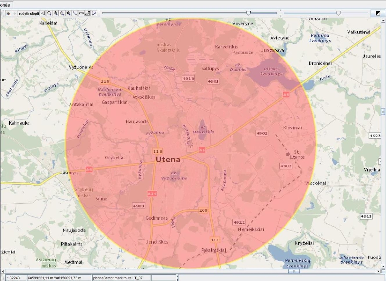
The simplest Cell ID method has been used to get coordinates of the specific tower whereto a mobile handset has connected and the area of its antenna coverage (service area) in many countries of the world so far, and it was used in Lithuania till end of 2016.
Such data had a large error, as in suburbia or rural areas the radius of the antenna coverage area was up to 30–40 km.

Example of the Cell ID method
Since the beginning of 2017, having implemented respective changes in networks of Lithuanian mobile operators, the Timing Advance / Round Trip Time method has been used in Lithuania, when the caller’s location (zone) is determined not only by handset’s connection to a mobile base station (tower), the area of the coverage of that station and the direction sector, but also based on the propagation time of the radio signal. Compared to the method used until 2017, the area of the caller’s location has decreased more than 10 times.

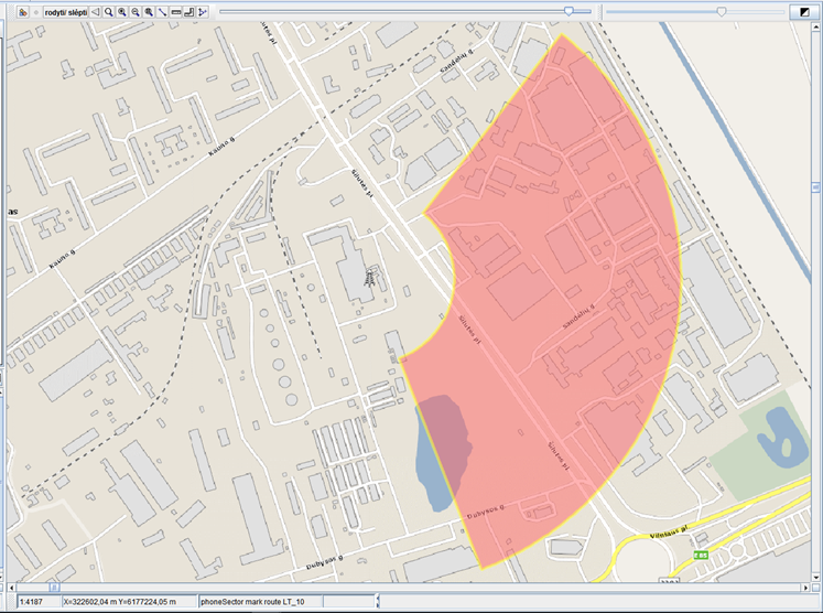
Example of the Timing Advance / Round Trip Time method
Around the same time, Google and Apple developed and started implementing the most advanced location system available today. When calling 112 from a smartphone with an updated Android or iOS operating system, the handset itself determines its location based on GPS, Wi-Fi or mobile radio signals and automatically sends its coordinates to 112 in a coded SMS. This method is called Advanced Mobile Location (AML).

The accuracy of the location data obtained by way of AML ranges from 6 meters to 1.2 kilometres.


The implementation of the AML function in Lithuania started in 2016 – at that time, Lithuania was the fourth country in the world that started using this most advanced location method. Currently, approximately 62% of calls in Lithuania come from devices with AML function.
Despite these advanced technologies, signal propagation measurements can be affected by a number of external factors (terrain, surrounding buildings, telephone model, and others) and there may be instances where the caller’s location is inaccurate, with errors.
Therefore, when answering a request for help, the main source of information about the location of the accident is the caller himself.